The current AGILE council comprises the following members:
- Co-Chair: Sabine Timpf (Augsburg University, Germany)
- Co-Chair: Rob Lemmens (University of Twente, The Netherlands)
- Secretary: Carlos Granell (Universitat of Jaume I, Spain)
- Co-Secretary: Jing Yao (University of Glasgow, Scotland)
- Treasurer: Simon Scheider (Universiteit Utrecht, The Netherlands)
- Carsten Keßler (Hochschule Bochum, Germany)
- Juha Oksanen (NLS - National land survey of Finland, Finland)
- Evelyn Uuemaa (University of Tartu, Estonia)
External officers support the work of the council:
- Susi Rosenfeld – administration
- Daniel Nüst (Technische Universität Dresden, Germany) – reproducibility officer
- Daniel Henzen (Technische Universität Dresden, Germany) – webmaster
Sabine Timpf (Co-Chair)
e-mail: sabine.timpf @ uni-a.de
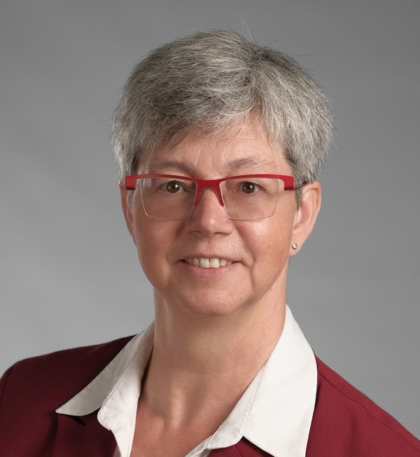
Sabine Timpf is a Professor at the Institute of Geography at the University of Augsburg, Germany. She currently serves as head of the institute and as the study programme coordinator of the Master and Bachelor in Geoinformatics. Prior to her current appointment she spent time as a postdoc at the Department of Computer Science of the University of Würzburg, Germany, and at the Department of Geography of the University of Zurich, Switzerland. She received her PhD from the Technical University of Vienna, Austria, a Diploma in Surveying Engineering from the University of Hannover, Germany, and an M.Sc. from the University of Maine at Orono, U.S.A.. Sabine’s research interests include geographic information science, geospatial intelligence, cognitive engineering, spatial modelling and simulation, spatial cognition in wayfinding, geocomputation and more recently agent-based modelling as an approach to model complex systems such as urban transportation. She has (co)authored more than 100 research papers and chapters published in peer-reviewed journals, conferences and edited books. She currently serves as co-editor of the German journal on Artificial Intelligence – KI.
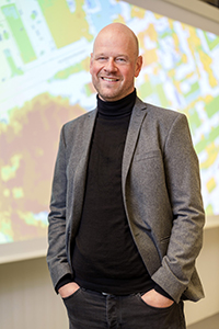
Rob Lemmens (Co-Chair)
e-mail: r.l.g.lemmens @ utwente.nl
Rob Lemmens is an Assistant Professor at the Department of Geoinformation Processing, University of Twente, Faculty of Geo-Information Science and Earth Observation (ITC). He holds a PhD in Geoinformatics from Delft University of Technology. He has expertise in semantic modelling, geo web technology, spatial data infrastructures, interoperability standards, volunteered geoinformation, workflow modelling and open source software development. Rob worked as a visiting scientist at Google in Mountain View, at City University of New York and at George Washington University, Washington, D.C., focusing on semantic models for collaborative mapping. Rob is involved in the Platform Linked Data Netherlands and organiser of several hackathons and mapathons, together with the Red Cross. He has worked in technology deployment and capacity building in Africa and Asia. In two European COST projects he co-created a VGI Knowledge Portal and co-edited a book on citizen science. He co-authored several publications on using the semantic web in learning environments, geoprocessing and geodata discovery. He is lead architect for ontology development for the Living Textbook application, which is currently deployed as editing tool for the EO/GI Body of Knowledge (http://www.eo4geo.eu/). He leads two other projects on modularising education into fine-granular shareable content and matching.
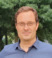
Carlos Granell (Secretary)
e-mail: carlos.granell @ uji.es
Carlos Granell is a Ramon y Cajal research fellow in the Geospatial Technologies research group (GEOTEC) at University Jaume I of Castellón (UJI) since December 2015. He was previously a postdoctoral researcher at European Commission–Joint Research Centre, Ispra (Italy), and a postdoc researcher in GEOTEC. Carlos graduated in Computer Engineering and received his doctorate in Computer Science and GIS (2006) from UJI under the supervision of Mike Gould. Carlos’ research covers multi-disciplinary GIS –where the “S” may stand for Systems, Software, Services, Standards, Science, Social Sciences, and Society–, spatial analysis & visualization, real-time streaming processing, data-rich web mapping applications, and reproducible research. He serves on the editorial board/associate editor of Computer and Geosciences, ISPRS International Journal of Geo-Information, PeerJ, Smart Science, and Journal of Open Research Software. His scientific publications on science and social science journals reflect the multi-disciplinary nature of his research interests.
Jing Yao (Co-Secretary)
e-mail: Jing.Yao @ glasgow.ac.uk
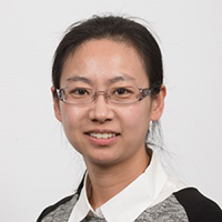
Dr Jing Yao is a Senior Lecturer in Urban Big Data and Quantitative Methods at University of Glasgow, UK. She has a PhD in Geography (2012) and a MSc in Industrial Engineering (2012) both from Arizona State University (ASU), USA. She also has a MSc degree (2005) and a BSc degree (2002) in Geographical Information System (GIS) from Nanjing University, China. Previously she worked as a postdoctoral associate at the GeoDa Center for Geospatial Analysis and Computation at ASU in the US and a research fellow at the Centre for Geoinformatics at University of St Andrews in UK. She joined University of Glasgow as a lecturer in 2014. Jing is currently a member of the UKRI-funded Urban Big Data Centre at University of Glasgow. She has participated in several international projects on sustainable urban development, urban and regional planning, and emergency planning and response. She is member of the editorial board of International Journal of Geographical Information Science, Transactions in Urban Data, Science, and Technology and Journal of Geodesy and Geoinformation Science.
Simon Scheider (Treasurer)
e-mail: s.scheider @ uu.nl
Simon Scheider is an assistant professor in geographic information science at the Department of Human Geography and Spatial Planning, University Utrecht. His research lies at the interface between conceptual modeling, geographic data analysis and knowledge extraction. He is particularly interested in understanding the concepts underlying spatio-temporal data, including reference systems, fields, places, spatial objects, events, trajectories and their relationship to human activities. He is doing research on AI and Semantic Web technology to support geographic analysis with GIS and to enable meaningful analytics of spatial information. One of his focus areas is geographic question-answering (geoQA) in the context of GIS. Simon received his PhD from the University of Muenster in Geoinformatics in 2012. He has co-authored more than 80 peer-reviewed publications in journals, conference proceedings and books. Prior to his current appointment in Utrecht, he was a post-doc at the Institute of Cartography and Geoinformation of ETH Zürich, Switzerland, a post-doc at the Institute of Geoinformatics in Münster, Germany, and a visiting scholar and research fellow at the Geography department of the University of California Santa Barbara, USA.
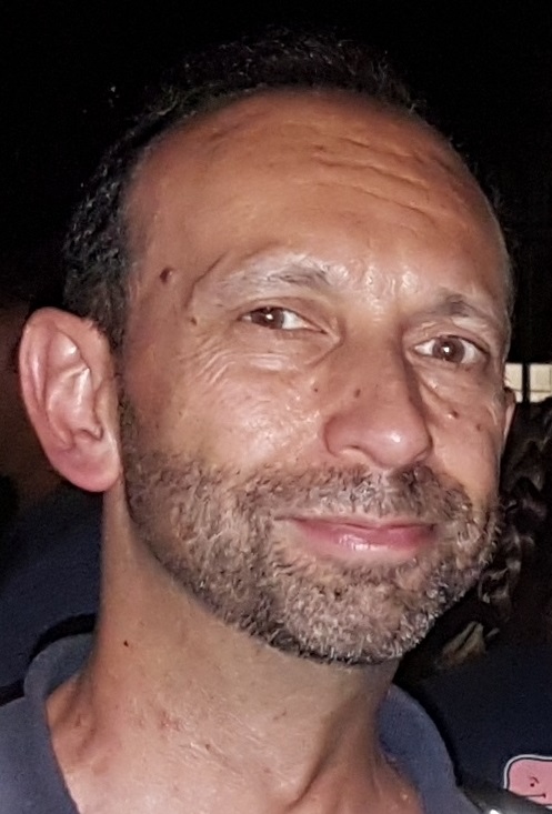
Carsten Keßler
e-mail: Carsten.Kessler @ hs-bochum.de
Carsten Keßler is a Professor for Geographic Information Systems and Spatial Data Analysis at Bochum University of Applied Sciences, Germany. Carsten started his career with a diploma (2004), PhD (2010), and Post-Doc at University of Münster, Germany, before working as a consultant for the United National Office for the Coordination of Humanitarian Affairs in Geneva, Switzerland (2012–2013). He then re-joined academia as Assistent Professor for Geographic Information Science at Hunter College, City University of New York, USA (2013–2016), before becoming Associate Professor (2016–2020) and then Professor (2020–2021) at Aalborg University (AAU), Copenhagen, Denmark. In Spring 2021, he moved back to Germany for his current position, while maintaining an affiliation with AAU. Carsten is currently co-coordinator of the H2020 project "Future Migration Scenarios for Europe", co-spokesperson of the German National Research Data Infrastructure for the Earth System Sciences (NFDI4Earth) and participates in several national and international projects around Spatial Data Infrastructures and Research Data Management. He is member of the editorial board of Transactions in GIS, the Journal of Location Based Services, the International Journal on Semantic Web and Information Systems and the International Journal of Spatial Data Infrastructures Research.
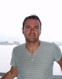
Juha Oksanen
e-mail: juha.oksanen @ nls.fi
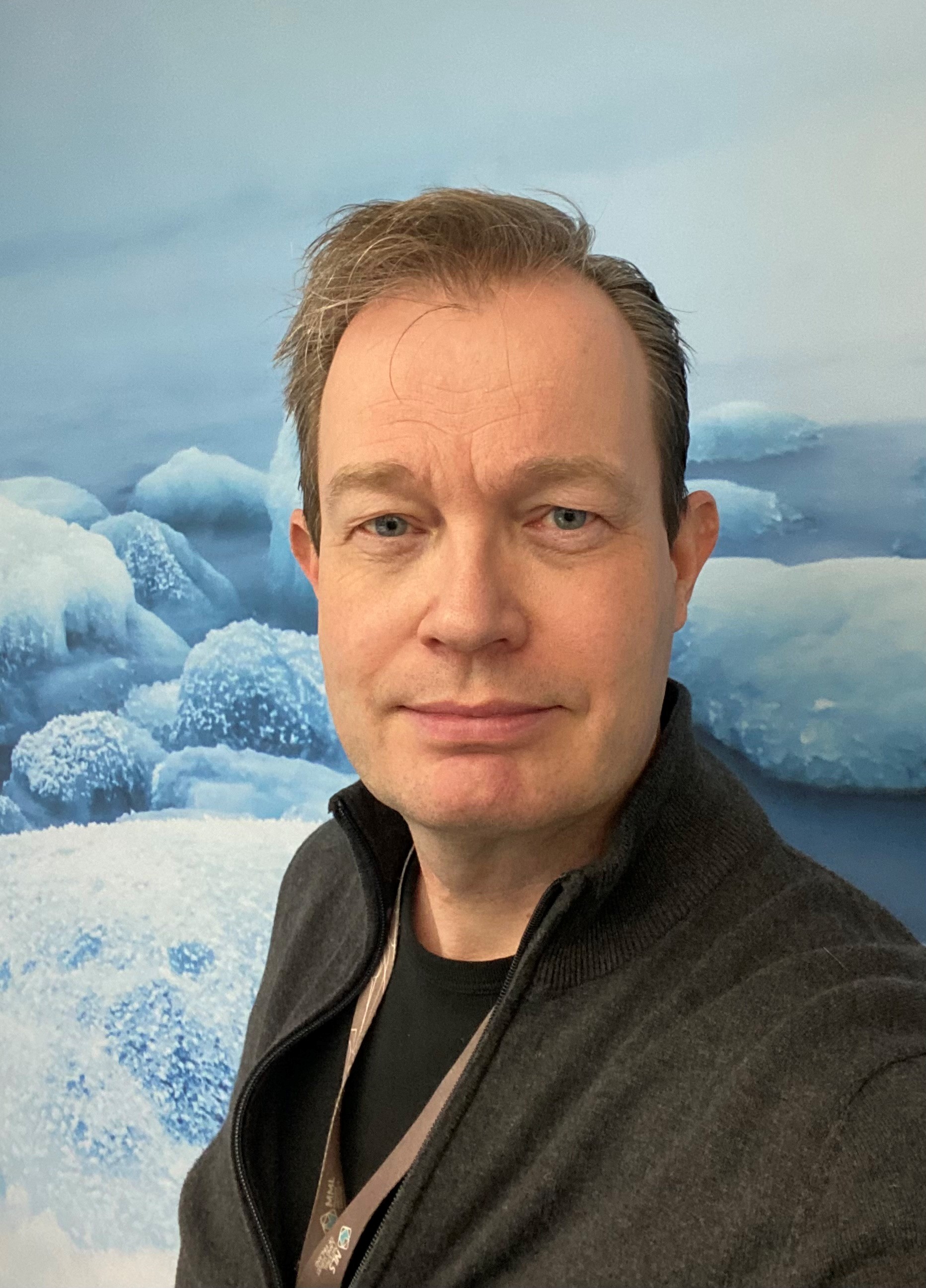
Juha Oksanen is the head of department and a professor of geoinformatics and cartography at the Finnish Geospatial Research Institute in the National Land Survey of Finland. In addition, he is an associate professor of geoinformatics in the University of Helsinki (UH). His long academic career in geographical information science started in the mid 1990s, when he was appointed as the first assistant of geoinformatics in the Department of Geography, UH. In late 1990s he started as a research assistant at the Finnish Geodetic Institute, did his PhD in 2006, became a research manager in 2012 and the head of department in 2018. Juha is currently the director of the national Open Geospatial Information Infrastructure for Research (Geoportti RI), which provides easy access to massive geospatial data and geocomputing resources for scientists in Finland. He is a member of the editorial board of the Journal of Location Based Services, a member of scientific committees of number of conferences, such as AGILE, ICC, EuroCarto, GIScience, Spatial Accuracy, and GIS Ostrava, and the chair of the Cartographic Society of Finland.
Evelyn Uuemaa
e-mail: evelyn.uuemaa @ ut.ee
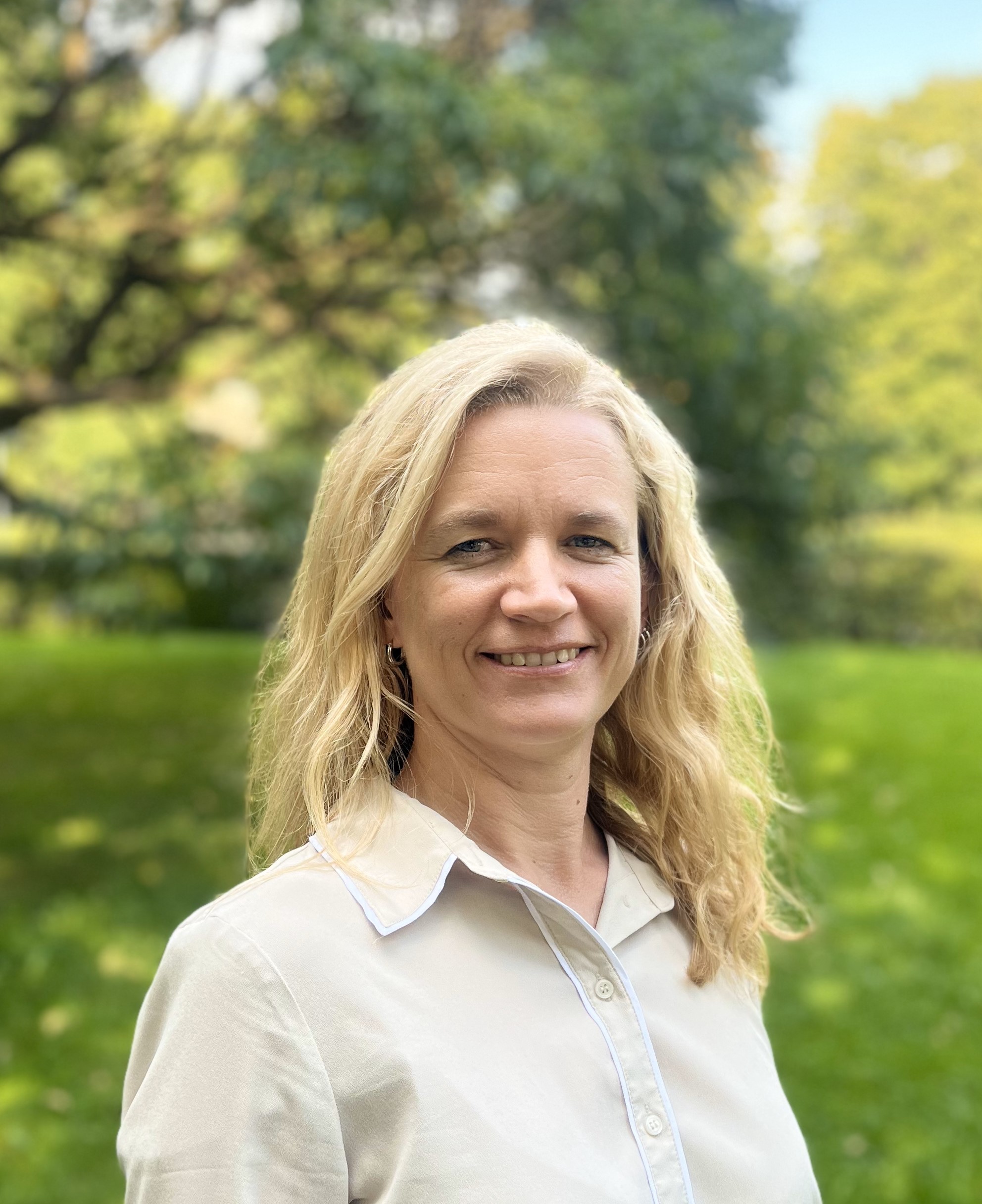
Evelyn Uuemaa is Professor in Geoinformatics and the lead of the Landscape Geoinformatics Lab at University of Tartu. She has MSc in Geoinformatics and PhD in Landscape Ecology from University of Tartu. She did her postdoc in National Institute of Water and Atmospheric Research in New Zealand. She has developed and is currently teaching several core GIS courses at MSc level and she is the project lead of the Erasmus+ Joint Master’s programme on geoinformatics and remote sensing at the University of Tartu. Her main research interests are in applying geospatial analysis on landscape changes and water & land nexus and in using spatial machine learning for predictive environmental modelling (e.g. soil organic carbon, water quality). She is also passionate about modern geospatial visualization methods, and she has three times fully participated in #30DayMapChallenge.
Susi Rosenfeld (administration)
e-mail: susirosenfeld @ web.de
As an external officer, Susi supports the council with administrative tasks, finances and membership management. She has a Master of Science in Physical Geography and has worked in the field of river rehabilitation in Germany as well as in logistics. In an art project she is currently researching the perception of public space and the habits and norms of moving in it.
Daniel Nüst (reproducibility officer)
e-mail: daniel.nuest @ tu-dresden.de
Daniel Henzen (webmaster)
e-mail: daniel.henzen @ tu-dresden.de
Daniel Henzen has a degree in media and computer science of the Technische Universität Dresden. He is now working at the Faculty of environmental sciences of the University of Dresden. His research fields are sensor web enablement and research data infrastructures.